The Witcher Map
Every Witcher 3 region and a lore map of the whole Continent. Free progress tracking, no account needed.
The whole Continent on one map
See where the Northern Kingdoms, Nilfgaard and Skellige sit, and where each game and the Netflix series takes place.
Explore the ContinentMade for using mid-game
Free progress tracking
Mark markers as found and hide them. Saved in your browser, no account, no paywall.
Several playthroughs
Keep a separate checklist for each save, and export it as a file to back it up.
Share any marker
Every marker has its own link, so you can send a friend the exact spot.
Search everything
Find a merchant, quest giver or treasure by name across the whole region.
Fast on phones
Lightweight pages, a bottom sheet for filters and maps that load in a moment.
Eight languages
English, Español, 日本語, Français, Deutsch, Português, 한국어 and Italiano.
A free, interactive Witcher map for every region
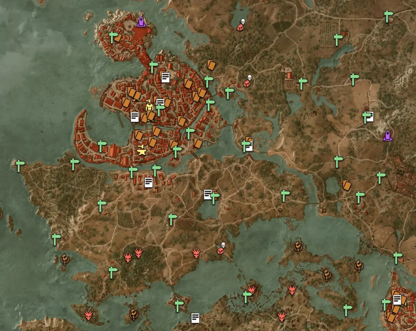
The Witcher Map is a complete, free Witcher map for The Witcher 3: Wild Hunt and its two expansions, Hearts of Stone and Blood and Wine. Every region of the game has its own interactive map with 2,883 markers in nearly 40 categories: signposts for fast travel, Places of Power, Gwent players, merchants and blacksmiths, monster nests, bandit camps, smugglers’ caches, treasure hunts and witcher gear. Each marker comes with a short note that tells you what is there and, where it matters, which quest unlocks it.
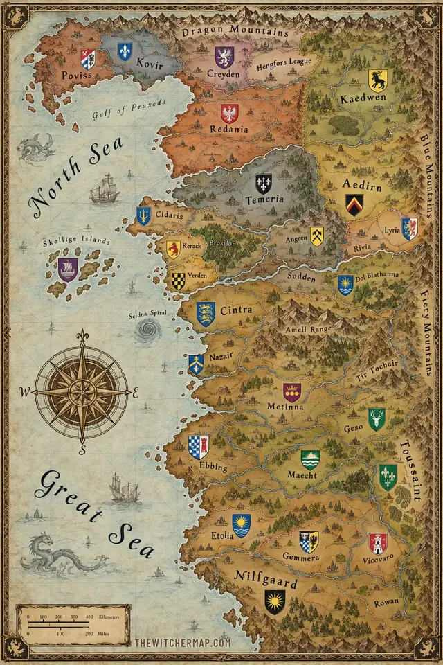
Next to the game maps, the site has a full world map of the Continent, the setting of Andrzej Sapkowski’s books, the three games and the Netflix series. It shows how the regions you explore in Witcher 3 fit into the wider world, which kingdom rules where, and where famous places like Cintra, Aretuza and Kaer Morhen are found. Everything runs in the browser, works on phones and needs no account.
Velen and Novigrad: the biggest Witcher 3 map
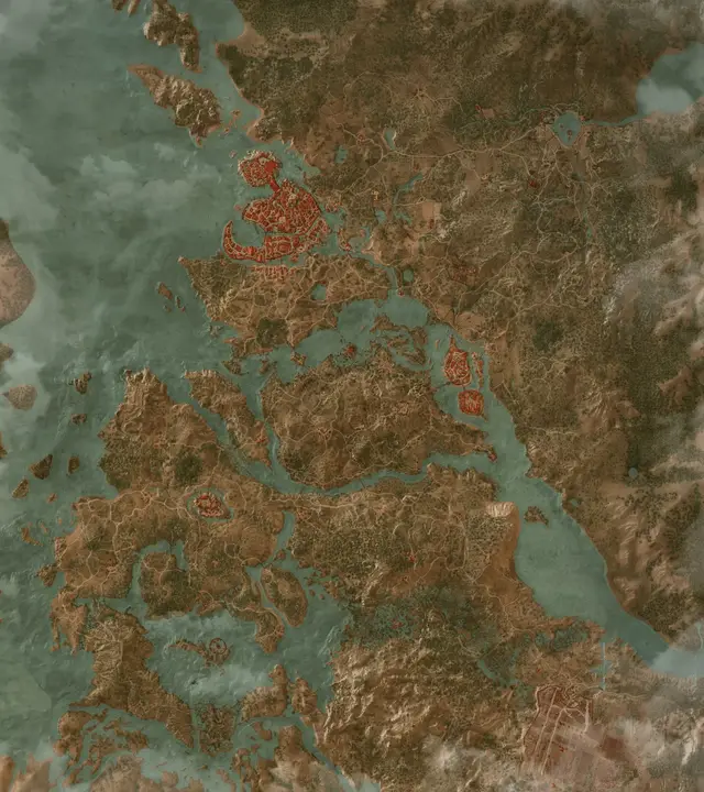
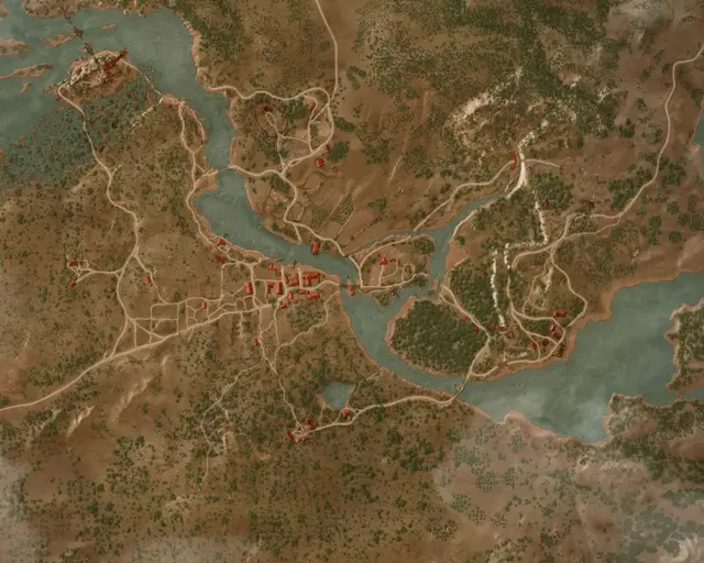
Most players spend the longest stretch of the game on the Velen and Novigrad map. It is the largest region in Witcher 3 and the densest one, with more than 1,300 markers. Velen fills the southern half: a war-torn no man’s land of swamps, burned villages and battlefields, where the Bloody Baron rules from Crow’s Perch and the Crones haunt Crookback Bog. North of the Pontar river lies Novigrad, the biggest city in the North, with the university town of Oxenfurt to the east. The Hearts of Stone expansion adds its quests and locations to this same map.
If you are hunting for something specific, each category has its own page with a list and a focused map, for example every Gwent player in Velen and Novigrad, every Place of Power or every blacksmith and what it takes to unlock them.
Skellige, Toussaint and the rest of the Witcher 3 world
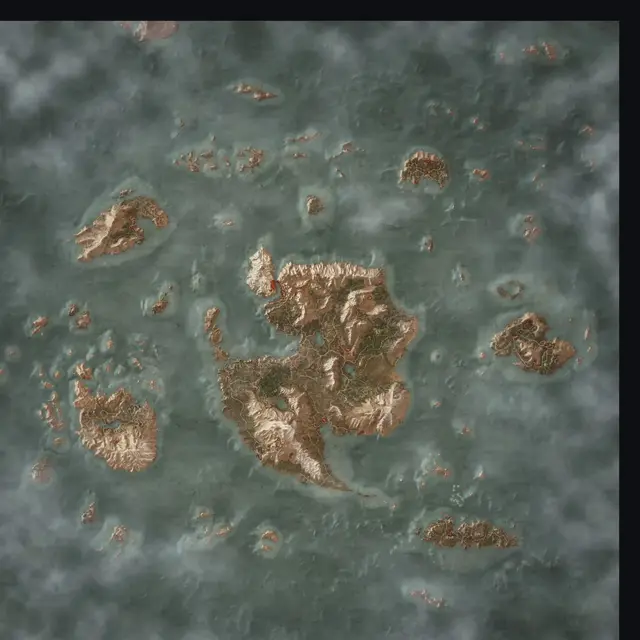
The Skellige map covers the whole archipelago: Ard Skellig with the clan seat of Kaer Trolde, An Skellig, Spikeroog, Hindarsfjall, Undvik and Faroe in the far south-east. Skellige is famous for its sea of question marks, and on this map the smugglers’ caches hidden along the coast are as easy to find as the villages.
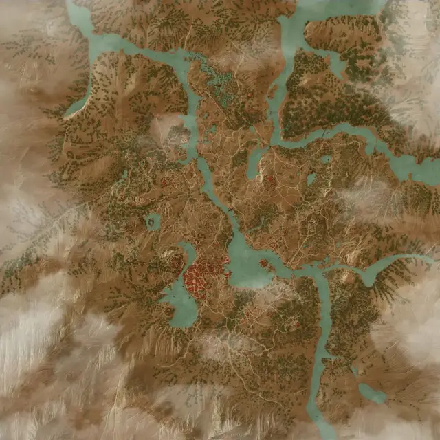
The Toussaint map from Blood and Wine is a sunny duchy of vineyards, knights and fairy-tale castles around the capital Beauclair, with its own Hanse bases, vineyard infestations and knights in distress. The smaller maps cover White Orchard, the Temerian village where the story begins, and Kaer Morhen, the old fortress of the witchers. Three story maps complete the set: the Isle of Mists, the Land of a Thousand Fables and Gaunter O’Dimm’s world. Together they make up the full Witcher map of the game.
The Witcher map of the Continent and its kingdoms
The map of the Continent is a world map of The Witcher, drawn as one illustrated map and marked with 35 kingdoms, cities and landmarks. In the north lie the Northern Kingdoms: Redania with its capital Tretogor and the free city of Novigrad, Temeria around Vizima, Kaedwen with Ard Carraigh and the Blue Mountains of Kaer Morhen, Aedirn with Vengerberg, and Kovir and Poviss on the far northern coast. Cintra sits at the mouth of the Yaruga river, the southern border of the North, and beyond it spreads the Nilfgaardian Empire with Toussaint as one of its vassals. The Skellige Isles lie out at sea to the west, and Zerrikania lies far to the east.
Click any place to see what it is and where it appears: which game you visit it in and whether it shows up in the Netflix series. That makes the map useful both for players who want to know where Witcher 3 is set and for readers looking up the kingdoms of the Witcher world. Aretuza, the school of magic on the island of Thanedd, is marked off the coast near the port of Gors Velen.
A high resolution Witcher map you can zoom into
The Witcher 3 maps are built from high resolution tiles of the in-game world map, so you can zoom in from a full overview of a region down to single farms, caves and roads. Markers are drawn on one fast canvas layer, which keeps panning smooth even with more than a thousand icons on screen, and a fullscreen button turns any map into a full witcher map that fills your monitor or phone.
Some players look for a Witcher map poster to keep next to the screen. This site is meant to be that companion, but one that you can search, filter and update as you play. The Continent map also opens fullscreen, so the whole world of The Witcher is one click away.
How to use the map while you play
Pick a region, then use the filters to show only what you need: switch everything off and turn on the treasure hunts you are working on, or show just the signposts to plan a route. The search box finds any merchant, quest or location by name. Click a marker to read its note, mark it as found, or copy a link that opens the map at that exact spot.
Your progress is saved in your browser, so the map remembers what you have found the next time you open it. You can keep a separate checklist for each playthrough and export it as a file. The layout is designed for phones and tablets too, with a sliding panel for filters and large touch targets, so you can keep the map open beside the game.
Where the map data comes from
The marker data and map tiles are based on witcher3map, a long-running community project, and its enhanced fork, both shared under the CC BY-NC-SA 4.0 license. We convert the data, clean up the notes, check every marker and translate the interface into eight languages. If you spot a missing or misplaced marker, please tell us through the contact page and we will fix it. The Witcher Map is an unofficial fan project and is not affiliated with CD PROJEKT RED.
Witcher map FAQ
Is The Witcher map free?
Yes. Every map and every feature, including progress tracking for several playthroughs, is free and needs no account.
How big is the Witcher 3 map?
Fan measurements put the base game world at about 136 square kilometres, roughly 52 square miles. Velen and Novigrad cover around 72 km² and Skellige around 64 km². Toussaint from Blood and Wine adds a large third region, and White Orchard, Kaer Morhen and the story areas come on top of that.
How big is the Witcher 3 map compared to Skyrim?
Skyrim’s world map is usually measured at about 37 km², or roughly 14 square miles. That makes the Witcher 3 base game about three and a half times larger, before counting Toussaint. These are community measurements, so exact figures vary between sources.
Where is Velen on the Witcher 3 map?
Velen is the southern half of the Velen and Novigrad map. It is a war-torn no man’s land south of the Pontar river, between Redania and Temeria. Novigrad lies to the north across the river and Oxenfurt to the north-east.
Where is Crookback Bog on the Witcher 3 map?
Crookback Bog is in southern Velen, south-east of Crow’s Perch near the village of Downwarren. The nearest signpost is The Orphans of Crookback Bog, which you can open directly on the map.
Where is Faroe on the Witcher 3 map?
Faroe is the smallest and southernmost of the Skellige Isles, in the south-east of the archipelago, south of Hindarsfjall and south-east of Ard Skellig. Its signposts are Harviken and Trottheim. Open Harviken on the Skellige map.
Where is Toussaint on the Witcher 3 map?
Toussaint has its own map, added by the Blood and Wine expansion. In the lore it is a duchy in the south of the Continent and a vassal of the Nilfgaardian Empire. In the game you travel there by taking the contract from a notice board in Velen or Novigrad that starts Blood and Wine. See the Toussaint map.
Where is Kaer Morhen on the map in Witcher 3?
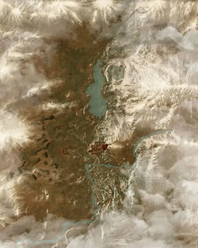
Kaer Morhen is a separate small map. The fortress stands in the Blue Mountains of Kaedwen, in the north-east of the Continent. You see it in the prologue and return there later in the main story. See the Kaer Morhen map.
Where is Aretuza on the Witcher map?
Aretuza, the school of magic for young sorceresses, is on the island of Thanedd off the coast near Gors Velen, in the west of the Northern Kingdoms. It is not part of the Witcher 3 world, but it appears in the books and the Netflix series and is marked on the map of the Continent.
Where is Letten on the Witcher map?
Letten is Dandelion’s homeland, which is where his title Viscount de Lettenhove comes from. It lies in northern Redania on the southern bank of the Nimnar river, roughly halfway between Kovir and Kaedwen. It is the setting of the Songs of the Past expansion and is not part of the current Witcher 3 maps.
Why is a blacksmith not on the map in Witcher 3?
The in-game map only shows craftsmen you have discovered, and several blacksmiths and armorers only start working after a quest. Hattori in Novigrad opens after Of Swords and Dumplings, Yoana after Master Armorers, and the smiths of Toussaint after you clear their area. Our blacksmith list shows every one with its unlock condition.
Where can I find Celandine in Witcher 3?
Celandine is a common herb that grows in meadows and along roads in White Orchard and Velen. If you need a lot of it, herbalists sell it; every herbalist is marked on the map, for example the herbalists of Velen and Novigrad.
How do you open the map in Witcher 3 on PS4?
Press the touchpad to open the world map on PS4 and PS5. On Xbox press the View button, and on PC press M. From there you can zoom out to switch regions.
Is there a high resolution Witcher map?
Yes. The Witcher 3 maps here use high resolution tiles that you can zoom down to single buildings, and every map, including the map of the Continent, has a fullscreen mode.
Does the Witcher map work on mobile?
Yes. The maps are built for phones and tablets, with a sliding panel for filters and large touch targets, so you can keep the map open next to the game.
Is this an official CD PROJEKT RED site?
No. The Witcher Map is an unofficial fan project. The Witcher and its assets belong to CD PROJEKT RED.